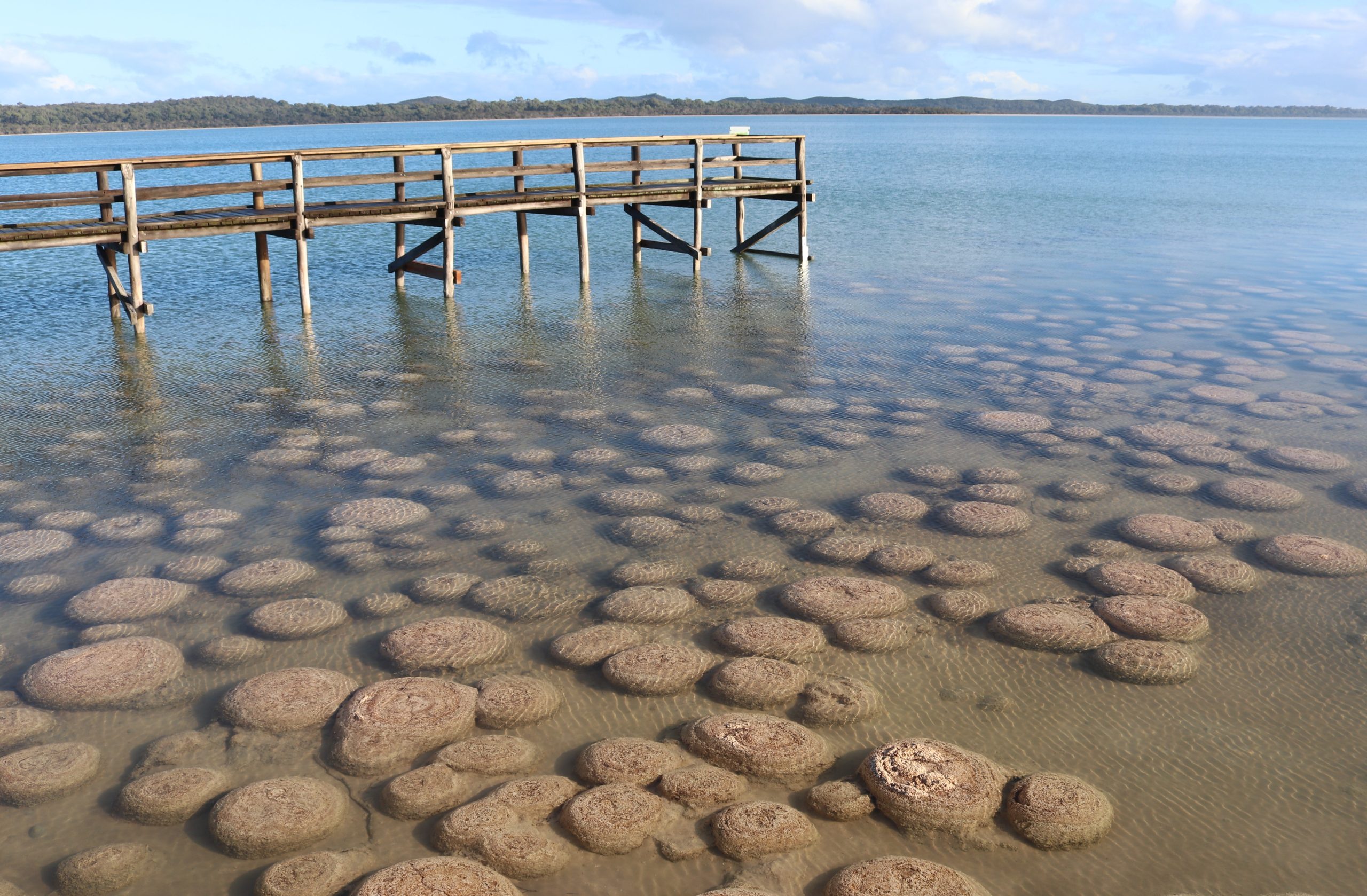
The Binjareb-Peel Geodirve Trail is situated on the West Coast of Australia on the Swan Coastal Plain, between the Indian Ocean and ancient pieces of the Earth’s crust, called the Yilgarn Craton to the East. The landscape of this region has been shaped by recent dynamic geological processes, but it has also been influenced by geological events that can be traced back billions of years.
The exposed rocks of the Yilgarn Craton are mainly granite and metamorphic rocks that range from 3.7 billion years to 2.4 billion years old. The Yilgarn Craton has experienced major change, including being part of the early supercontinents. A continental collision 1 billion years ago with ancient parts of Africa, India, and Antarctica collided with the western edge of the Yilgarn, forming a major mountain belt known as the Pinjarra Orogenic Belt.
The most recent supercontinent was Gondwana which began to break up 180 to 130 million years ago. Africa and India rifted apart and moved away from the West Coast of Australia with the birth of the Indian Ocean. Antarctica split from the south coast of Western Australia while it stayed attached to the southeast of Australia. Major rifting occurred along the Darling Fault with the land moving downward to the west creating a depression known as the Perth Basin.
Over time the mountain range on the western edge of the Yilgarn wore down through the processes of weathering and erosion. Ancient grains were removed from the Yilgarn and transported by river systems into the Perth Basin. The basin would gradually fill with 8 to 15 kms of sedimentary material and the mountain range would be reduced to a low range of hills that is referred to as the Darling Scarp.
The rest of the Australian continent finally split from Antarctica and began its voyage north 40 million years ago. As the continent moved north it began to become warmer and drier with deserts forming in the continent’s interior.
These major geological processes created the Indian Ocean, Southern Ocean, and the deserts to the north and east, isolating the South West of Australia from the rest of Australia and the world. This isolation has allowed the evolution of an incredible amount of endemism, making the fauna and flora of the region truly unique.
The Australian continent has been relatively stable geologically for the past 40 million years. The major changes have been due to the rise and fall of the sea levels due to glacial and interglacial periods.
The relatively flat laying surface expression of the Perth Basin is the Swan Coastal Plain, which has been sculptured by rivers, waves, and wind. The Swan Coastal Plain consists of old dune systems of quartz sand and calcium carbonate, deposited along shorelines during different sea levels.
Depressions between these old dune systems are expressed as lakes, estuaries, wetlands, and shallow coastal waters between the shoreline and offshore reefs. Sea levels in the past 700, 000 years have ranged from 10km inland to 40km seaward from the present-day shoreline. Landforms such as dune systems, reefs, limestone karst formations, lakes, estuaries, and rivers all preserve the rich geo-heritage values of the region. The landscape tells a story of the processes of the past and reminds us that the landscape is under constant flux.

